

On road ways & steep paths proceed through Alpine terrain to the highest point of the tour to Ehrenbachhöhe.…
From here hike on the ridge of the Hahnenkamm through Kitzbühel‘s ski area, across to the Hahnenkamm mountain station, before the descent proceeds along the Streif race route to Kitzbühel. There is information, with signboards provided about the individual well-known route sections (e.g. Mausefalle). Some sections have breath-taking views to Kitzbühel and the Wilder Kaiser.
From the centre of the town of Kirchberg head to the church and through Neugasse and Möselgasse up to a wooden house which has a yellow hiking signpost for Maierl 1 ½ hours. Branch off to the left here into Kasbachweg and hike through pastures up to the edge of the forest. At the houses change to the left on a steep path into the forest.
This lovely path soon heads into open pastureland again and later you continue hiking on an asphalt access road past the car park for a gondola (use the Maierl, No. 11 to get your bearings). Continue to ascend now slightly on a road that passes a farm, until you come to the edge of a forest. A forest road branches off to the left here (Bergschenke Krin, Ochsalm).
On this route which is somewhat steeper, proceeding in several serpentines through the forest, continue heading uphill until you come to open Alpine pasture/ meadows. Proceed on a lovely meadow path which proceeds steadily uphill, until you come to an asphalt access road beneath Bergschenke Krin.
Pass the guesthouse and continue on the road to Maierl. You will soon come to the plateau which has Gasthaus Maierl and dreamy views to all of the Wilder Kaiser. Around 200 meters before the guesthouse, a forest trail branches off; keep heading for Ochsalm. After around 300 metres take a sharp right and after another hundred metres on the left take a steep path into the forest.
This path now climbs straight up through the forest, continuing through a meadow and then there is a soft left into the forest again. There is now another short section up through the forest, then afterwards the route proceeds less steeply through Alpine terrain until you reach a forest path. To the right of this there is a short section slightly downhill, then the route ascends again up to the Ochsalm (1,458 m; 2 hours from Kirchberg).
Hike on this forest trail now to Ehrenbachhöhe. You will soon come to the saddle (approx. 100 m to the north of Gasthaus Hochbrunn). Take a left here, continuing to Ehrenbachhöhe and after not even a hundred metres, head left up on a hiking path to Ehrenbachhöhe (1,802 m; 1 hr 15 mins from Ochsalm).
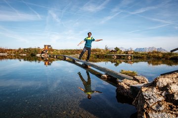
At the top get your bearings and orient yourself to Ehrenbachhöhensee, then hike behind the lake on a short section through the pastureland up to Bernhardkapelle chapel. Continue now on the forest path over to the nearby Hahnenkammbahn (1668 m; 45 minutes from Ehrenbachhöhe).
There is an option to shorten the route here and head straight down to Kitzbühel on the gondola.
Anyone who has enough energy left to keep hiking can head for Hocheckhütte, which is beneath the mountain station, and through the ski area down to the Seidlalm. Hike directly along the renowned Streif race route (Streif race route trail No. 26). Mausefalle, Steilhang and Hausbergkante are household names.
The route proceeds via Seidlalmsee, which can be seen far and wide, to the Seidlalm (1,206 m). After the Seidlalm head along the race route to Lärchenschuss. Cross Lärchenschuss and follow the hiking path through a short section of forest to the Hausbergkante. The final big screen is at the Hausbergkante (watch the skiers in action live here).
The descent proceeds straight across the Hausbergkante to the Ganslern slalom slope.
The zig-zag path leads us past Ganslern Alm, passing the fastest section of the race route (where speeds of up to 140 km/hr are reached).
The finish area is used as a golf course in the summer. The path now proceeds to the Hausbergtal road, follow this down into the valley and the signposts for Kitzbühel‘s Hahnenkammbahn valley station (approx. 2 hours from the Hahnenkamm mountain station). From the valley station it is around 5 minutes to the centre of Kitzbühel.
KAT Walk Compact stage 3: Pure World Cup - Feeling From the Hahnenkamm via the legendary Streif
Description
Multi-day long-distance hiking trail through the Kitzbühel Alps. Stage 3 of 5: Kirchberg in Tirol - Kitzbühel
equipment:
Breathable outdoor clothing, sufficient food and drinks, first aid equipment, mobile phone with full battery & charger, hiking map & guide books, possibly GPS device or load the GPS data onto the mobile phone, sun protection (sunglasses, sunscreen & hat), rain cover, cash

Events
Loading...
Up to date
Loading...
Loading...
Loading...
Accommodation
Accommodation
Loading...